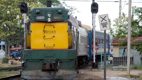
The establishment of the Global Positioning System (GPS) in the Base Business Unit (UEB) Raiways will reinforce the control of the movement of trains and the fuel used for the transportation of passengers and cargo in Ciego de Ávila.
Osmel González Pardo, head of the Energy Group of the aforementioned UEB, stressed that once the epidemiological complexities in the country are solved, specialists from the Central-West Railway Company, based in the province of Camagüey, should start the installation of this system in the Ciego de Ávila`s territory, taking into account that they have the equipment.
The GPS will make possible to accurately detect the location of trains, establish out-of-place stops and parking delays that could be related to the illegal loading of large volumes of goods.
“This technology will complement the UEB's efforts in confronting excessive transportation of resources for their subsequent commercialization in the informal market, which has been worked on in recent years, after establishing restrictions that include the prohibition of moving certain products and limitations to take others, ” José Oriol Carreras del Río, deputy director of the UEB, said.
González Pardo also announced that the effectiveness of an electronic system for measuring the fuel tanks of locomotives and other railway equipment is being studied and analyzed.
In line with the country's strategies for the rational use of fuel, Ciego de Ávila`s Railways periodically analyzes the flow of information on expenses and their correspondence with the traveled distances. Likewise, it performs surprise measurements on the train tanks. Such actions allow timely action when irregularities in consumption are detected.
According to information from the Granma newspaper, GPS is not only aimed at controlling fuel, but also influencing the efficiency of transport exploitation indicators, for example, the use of trips, and the technical maintenance of equipment.
“In addition, the use of this technology allows a more effective control of criminal acts. The administration of the fleet management and control system provides directly to the Investigative Technical Police the information regarding the route used by the vehicles involved in the events,” the Official Body of the Party's Central Committee said.
A report from the digital site Cubahora reports that GPS “determines the location of any object, person or vehicle throughout the Earth, with an accuracy of centimeters, although it is usual few meters. It was developed by the United States Department of Defense and requires four satellites to function.
“GPS works through a network of at least 24 satellites in orbit over the Earth, at an altitude of approximately 20,000 kilometers, with distributed orbits so that at all times there are at least four satellites visible at any point on the planet. When you want to determine a three-dimensional position, the receiver automatically locates at least four satellites in the network, from which it receives signals indicating the identification and time of the clock of each one of them, as well as information about the constellation”.
Based on American inventiveness, other powers have developed their own systems to become independent from the original, in the face of threats of "turning it off" in cases of conflict.


