")


The clouds associated with tropical storm Elsa cover a large part of the eastern and central regions of Cuba. Bands are generating heavy drizzles and rains over Granma, Las Tunas, Camagüey, Ciego de Ávila and Sancti- Spíritus. In the Cilantro dam, located in Pilón, Granma, a cumulative 66 millimeters was recorded in two hours. Just in 3 hours, 55 millimeters were recorded in Cabo Cruz, Granma and 32 millimeters in Contramaestre, Santiago de Cuba.
In the south eastern portion, sustained winds with tropical storm force have been recorded during the afternoon. The Cape Cruz weather station reported sustained winds of 60 kilometers per hour, a maximum east-southeast gust of 85 kilometers per hour.
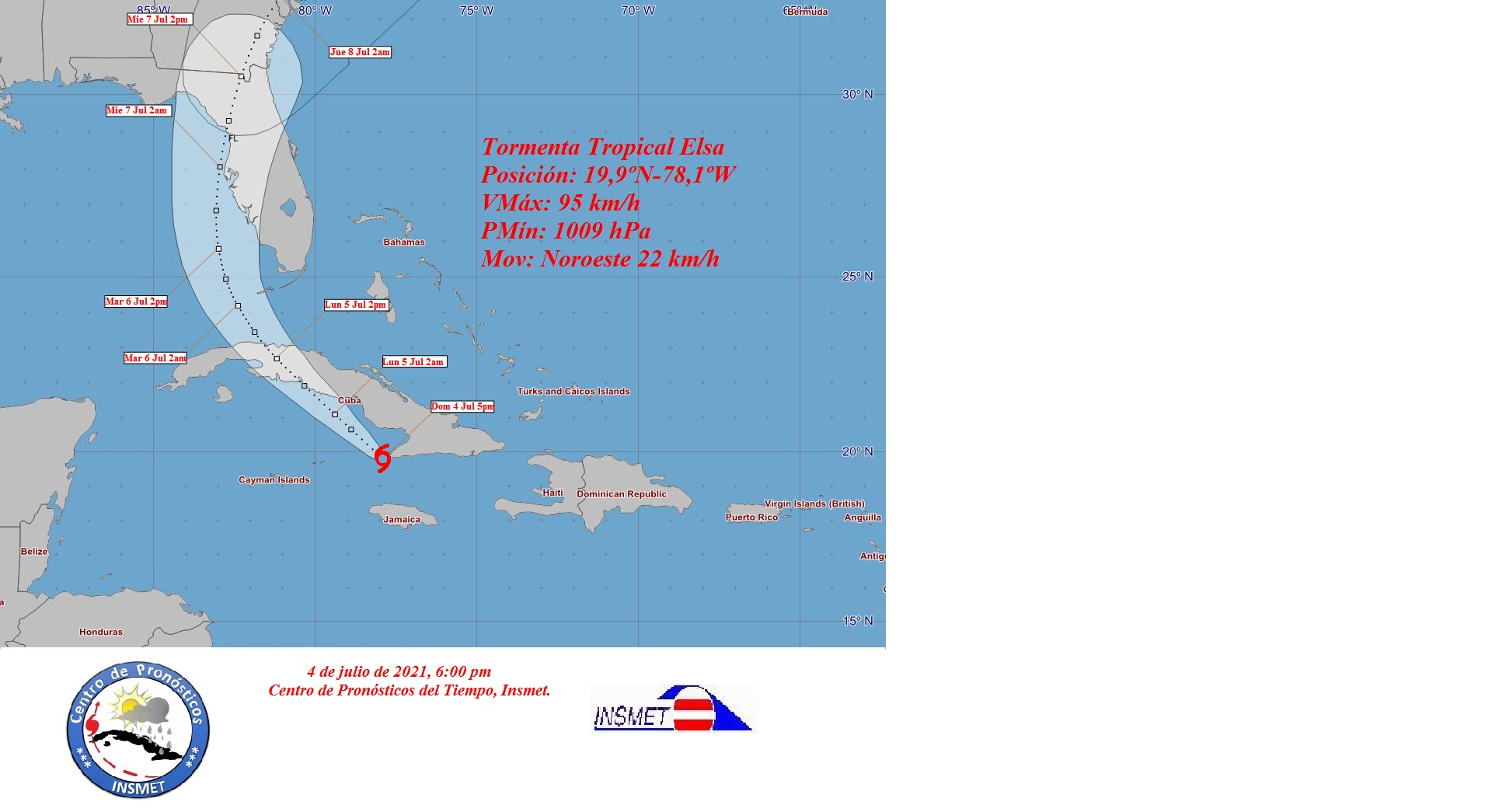
At 6:00 p.m., the center of tropical storm Elsa was estimated at 19.9 degrees North latitude and 78.1 degrees West longitude, a position that places it 90 kilometers south of Santa Cruz del Sur, Camagüey.
Elsa is heading northwest at about 22 kilometers per hour, with little change in intensity. It maintains maximum sustained winds of 95 kilometers per hour and its central pressure is 1009 hectoPascal.
In the next 12 to 24 hours, Tropical Storm Elsa will continue heading northwest, with a similar speed of translation and could gain slightly in organization and intensity before penetrating land. It will travel over the seas near the Jardines de la Reina, approaching the southern coast of the central region. Clouds and rains will continue to affect the eastern region of Cuba and gradually include the central provinces, being strong and intense, mainly in mountainous locations.
In the eastern region and up to Camagüey, the winds will blow with speeds between 60 and 75 kilometers per hour, with higher gusts that will reach tropical storm force of up to 100 kilometers per hour.
The strong swells will continue in the south of Granma, with waves between 4 and 6 meters in height and light to moderate coastal flooding, on the southern coast of Granma, as well as they will be light in the Guacanayabo Gulf and will begin at night on the southern coast of the central region of Cuba.
The next tropical cyclone warning will be issued at 9:00 pm on Sunday.