")


Studies in sugarcane plantations, with the use of advanced technologies (drones with real image and multispectral cameras, and satellite snapshots) will favor the development of the 2021-2022 sugar harvest at the Ciro Redondo Agro-industrial Company, in the province of Ciego de Avila.
The Master of Science Homero Menéndez Pérez, director of the Geocuba Remote Sensing Agency, specified that the use of these means made it possible to determine the reality and condition of the crops, with details on the presence of vines that make mechanized and manual cuts difficult.
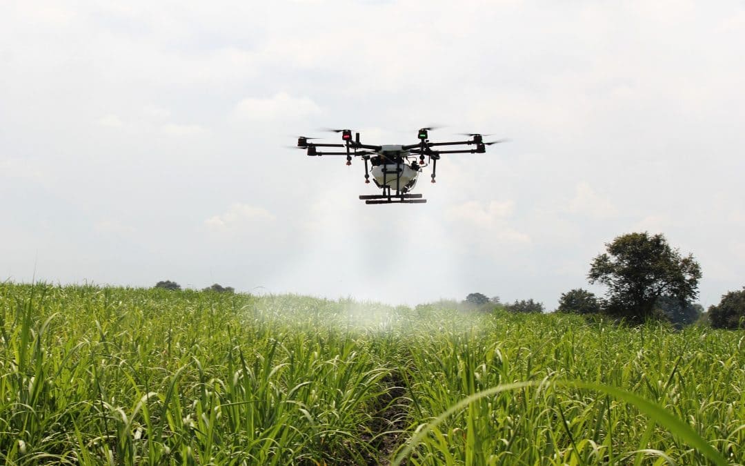
After the presence of this weed was identified, the fumigation with the use of drones was planned, in order to humanize the work in the fields during the next sugar contest, he stressed.
He explained that monitoring would be carried out through satellite images to determine the quantity of sugarcane, its maturation and the most suitable moment for the cuts, which will allow a better use of the cultivated areas to obtain sugar and other derivatives.
Moreover, Working with the Azcuba Sugar Business Group in the reorganization of its plantations, Geocuba updates the agricultural, tobacco and forestry cartographic bases in the country for the use of the Ministry of Agriculture, a process that must conclude in the first half of 2022 year, he said.
In the province of Ciego de Ávila, with productions that contribute to the national balance, these studies are at 80 percent of their execution, which allows to have information on the sowings, the status of extensive crops such as sugarcane, meats and fruit trees, and the conditions of the irrigation systems, he assured.
The territory of Ciego de Ávila is a pilot in carrying out these inquiries, which will contribute to its adaptation to climate change, the effects of which will be strongly felt in agriculture, due to the rise in mean sea level and, as a consequence, the salinization of the waters and soils, he emphasized.
The Military Agricultural Union of that province will benefit from the allocation of drones, devices that will replace spraying with tractors, which will prevent soil compaction and damage caused to plantations by heavy machinery, he held.
Menéndez Pérez argued that these teams are capable of spraying up to three hectares per flight, at a rate of three every 15 minutes and about 80 daily, saving fertilizers, minimizing damage to the environment and avoiding damage to neighboring fields.
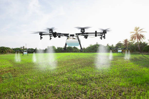
By having cameras with high performance, drones can identify, in a timely manner, the areas affected by pests or weeds, which allows them to be programmed to fumigate specific sites, he explained.
Coupled to unmanned aircraft, RGB cameras (for its acronym in English, allusive to the red, green and blue colors), are devices that have a sensor that measures the capacity of light within the visible spectrum in three colors, according to the Iberdrone website.
With them, this platform exposes, it is possible to interpret the tones depending on the damage to vegetation and crops, flooded areas, or other anomalies on the land, so they are a good option to start in precision agriculture.
“Multispectral cameras allow us to go further and capture radiation invisible to the human eye and interpret them in color. These devices capture more than three colors, called spectral bands, and can reach up to six bands”, the platform argues.
In terms of precision agriculture, these sensors can capture and calculate vegetation indices that indicate the well-being and health of plants; it is possible to detect and compare the characteristics of the flora and the crops to prevent future damages and pests that affect the productions.