")


During today's morning, Tropical Storm Ian has continued to move towards the west-northwest, gaining in organization, with the development of rainy areas around its center of circulation and creating feeding bands.
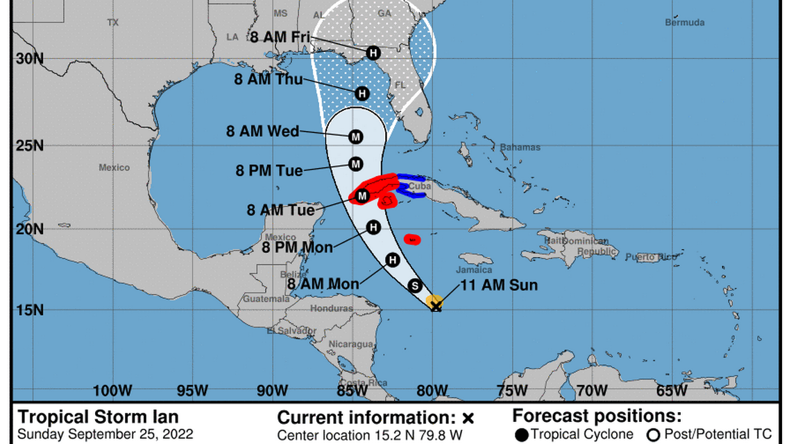
However, it remains with little change in its intensity; data from a reconnaissance plane indicates that its maximum sustained winds remain at 85 kilometers per hour, with higher gusts. Its minimum central pressure has dropped slightly to 1001 hectoPascal.
It has moved in a near west-northwesterly direction, with a slight increase in its translation speed to 22 kilometers per hour.
At noon today, its central region was estimated at 15.3 degrees North latitude and 80.0 degrees West longitude, a position that places it in the waters of the central Caribbean Sea 470 kilometers south of Cayman Grande and 900 kilometers southeast of San Antonio Cape, western end of Pinar del Río.
In the next 12 to 24 hours, this tropical storm will begin to tilt its path to the northwest with a similar travel speed. This will lead it to transit in an area with favorable conditions so that it continues to rapidly gain organization and intensity and could become a hurricane later today.
The Forecast Center of the Institute of Meteorology maintains a close watch on the evolution and future trajectory of this tropical cyclone organism, due to the potential danger it represents for western Cuba.
Given its position and forecast trajectory, Tropical Storm Ian could cause strong and intense winds and rains in western Cuba, as well as coastal flooding in low-lying areas of the southern coast starting on Monday, September 26.
The next tropical cyclone warning for this system will be issued at 6 p.m. today, Sunday.